Ceraunian Mountains
Ceraunian Mountains
A 100 km coastal range in southwestern Albania, the Ceraunian Mountains peak at 2,044 m at Çika Peak and overlook the Riviera from Vlorë to Sarandë.
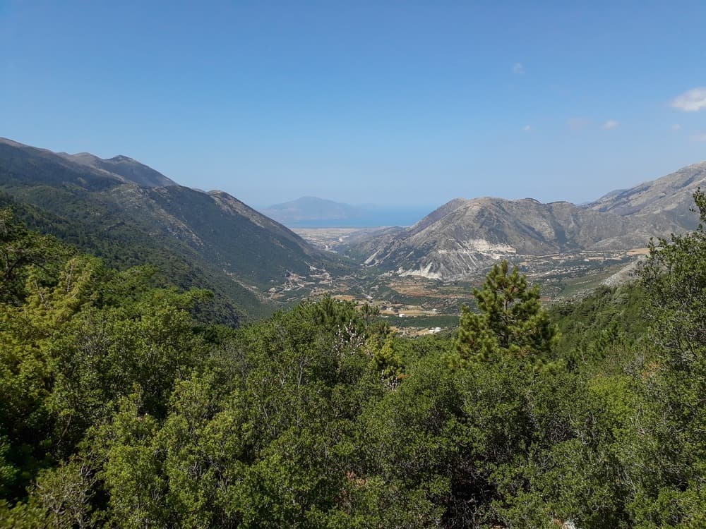
The Ceraunian Mountains form a coastal barrier of approximately 100 km in southwestern Albanie, in the Vlorë region. Known in Albanian as Mali i Kanalit ("Mountains of the Channel") and in ancient Greek as Κεραύνια ὄρη, "the peaks split by thunder," they dominate the Ionian coast and rise to 2,044 m at Çika Peak (Maja e Çikës). This range marks the transition between the Albanian Riviera and the mountainous hinterland, from the Llogara Pass to the Karaburun Peninsula.
Why visit the Ceraunian Mountains
Few European massifs offer such proximity between high mountains and sea. Within several kilometers, the terrain shifts from a ridge above 2,000 m elevation to the beaches of the Riviera, making it possible to combine mountain hiking and swimming in the same day. The range also encompasses Llogara National Park and preserves dense historical memory, from the writings of Strabo to the passage of Julius Caesar.
- A ridge 24 km long and 7 km wide, accessible from the coast
- Continuous panoramas over the Ionian Sea and, on clear days, views of Corfu
- Nomenclature inherited from ancient Greek and Roman times
- Coastal villages (Dhërmi, Palasë, Himarë) at the foot of the massif
History and nomenclature
The Ceraunians appear in Antiquity in the writings of Ptolemy, Pausanias, and Strabo. Their Greek name, Κεραύνια ὄρη, evokes the violent storms that strike the summits: "the peaks split by thunder." The Albanian form Mali i Kanalit, "Mountains of the Channel," refers to the maritime passage separating the coast from Corfu.
In Greek mythology, the region corresponds to ancient Epirus, where tradition places the Abantes from Euboea during the Trojan War. In the Roman period, in 49 BCE, Julius Caesar crossed the Llogara Pass during his pursuit of Pompey the Great and made a stop at Palasë, on the maritime slope of the massif. These accounts have permanently associated the Ceraunians with the major military routes between the Italian peninsula and the Greek East.
What to see and do
The Llogara Pass and National Park
The Llogara Pass, which separates the eastern and western mountains, is the main access point. It marks the entrance to the neighboring national park and opens onto one of the most beautiful viewpoints on the Albanian coast. The Llogara Park, which covers part of the massif, groups pine forests, beech groves, and viewpoints over the Riviera.
Çika Peak
At 2,044 m, Çika Peak (Maja e Çikës) is the highest summit of the chain. Climbing it requires a full day from the pass on an unmarked trail that demands good terrain reading skills. The reward: a 360° view over the Ionian Sea, the Strait of Otranto, and the Albanian hinterland.
Hiking, paragliding, and coastline
The massif is suitable for several activities:
- Hiking: ridge trails, crossings of Llogara Park, descents toward coastal villages
- Paragliding: the takeoff from the Llogara Pass, facing the sea, is a regional classic
- Light mountaineering on the ridges of Çika Peak
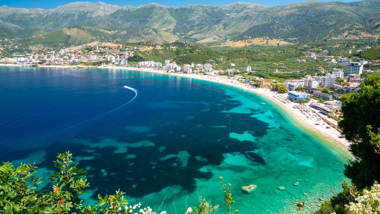
- Swimming in the coves of Palasë, Dhërmi, and Himarë, directly below the chain
The neighboring peninsula extends the massif toward the north: see our entry on the Karaburun Peninsula.
When to visit
The best period spans from late May to early October. Summer offers dry days and pleasant temperatures at altitude, while the coast remains warm. Spring and early fall are suitable for hiking: moderate temperatures, passable trails, and limited crowds.
Winter is harsh on the summits. Annual precipitation can exceed 2,000 mm on exposed slopes, with frequent snow and storms. Driving the Llogara Pass becomes tricky then.
Practical information
- Duration of visit: allow half a day to drive through the pass with scenic stops, a full day for a hike, two to three days to explore the massif and coast
- Equipment: hiking shoes, windbreaker (the pass is windy), plenty of water, map or GPS trace if trails are unmarked
- Accommodation: guesthouses and hotels at the Llogara Pass, in the villages of Dhërmi, Himarë, and Palasë
- Level: from simple scenic stops to challenging hikes depending on chosen itinerary
How to get there
- From Tirana: approximately 200 km via SH4 then SH8, about 3.5 to 4 hours' drive via Vlorë
- From Corfu (Greece): ferry to Sarandë, then drive up SH8 about 80 km to the pass
- By bus: regular connections between Tirana, Vlorë, Sarandë, and Riviera villages; possible stop at Llogara Pass
- By rental car: recommended option to combine the massif and coastal villages
Nearby
- Karaburun Peninsula: maritime extension of the range, accessible by boat from Vlorë
- Germenj-Shelegur National Park: another protected area in southern Albanie
- Korçë Archaeology Museum: to further explore the region's history
Frequently asked questions
In southwestern Albanie, Vlorë region. The range stretches for approximately 100 km along the Ionian coast, from the Llogara Pass to the Karaburun Peninsula and the Strait of Otranto.
Çika Peak (Maja e Çikës), at 2,044 m. Climbing it requires good physical fitness and a full day starting from the Llogara Pass.
From late May to early October. Winter is marked by heavy rainfall and snow at altitude, with annual precipitation possibly exceeding 2,000 mm on exposed slopes.
Yes, this is one of the massif's main attractions. The villages of Palasë, Dhërmi, and Himarë are directly below the summits, making it possible to hike in the morning and swim in the afternoon.
Plan your trip
The Ceraunian Mountains fit naturally into an itinerary combining the Albanian Riviera, Vlorë, and the south of the country. To build your bespoke journey, consult our trips to Albanie.
Interested in this visit?
We can include it in your personalised itinerary.