Mount Gjerë
Mount Gjerë
A limestone massif in southern Albanie, Mount Gjerë separates the Drino valley from the Ionian coast and harbours the karstic source of the Blue Eye. Peaks reach 1,800 m.
A little-known massif in southern Albanie, Mount Gjerë (Mali i Gjerë in Albanian) separates the Drino valley from the Ionian coast. Its limestone ridges dominate Gjirokastra to the east and Delvina to the west, and are home to the karstic source of the Blue Eye, one of the country's most visited natural sites.
Why visit Mount Gjerë
Mali i Gjerë combines several interests rarely found together on a single Albanian massif: accessible peaks ranging between 1,500 and 1,800 m, two heritage towns on its slopes, and a spectacular karstic source at its base. The area remains sparsely visited outside the Blue Eye, with a regional density of roughly 27 inhabitants per km², making it an unspoilt hiking terrain. It also makes a natural complement to a visit to Gjirokastra, a UNESCO World Heritage site, whose old town can be discovered from the heights of the massif.
What to see and do
The massif's peaks
Mount Gjerë is not a single summit but a ridge line formed by several high points:
- Mali i Frashërit: 1,800 m, the highest peak on the massif
- Mali i Nikollaqit: 1,598 m
- Mali i Pusit: 1,564 m
The trails are suitable for day hikes as well as longer traverses between slopes. Waymarking is basic: a topographic map or GPS track is recommended.
The Blue Eye (Syri i Kaltër)
On the western slope, near the village of Muzinë, the Blue Eye is a karstic source whose exact depth has yet to be measured. Water rises from a circular cavity whose centre appears deep blue, ringed by a turquoise band. The source feeds the Bistrica river. Marked trails lead to the main viewing point, and several small caves and watercourses can be visited in the immediate surroundings. Visitor numbers are high in summer: visiting early in the morning helps avoid tour groups.
Gjirokastra and the eastern slope
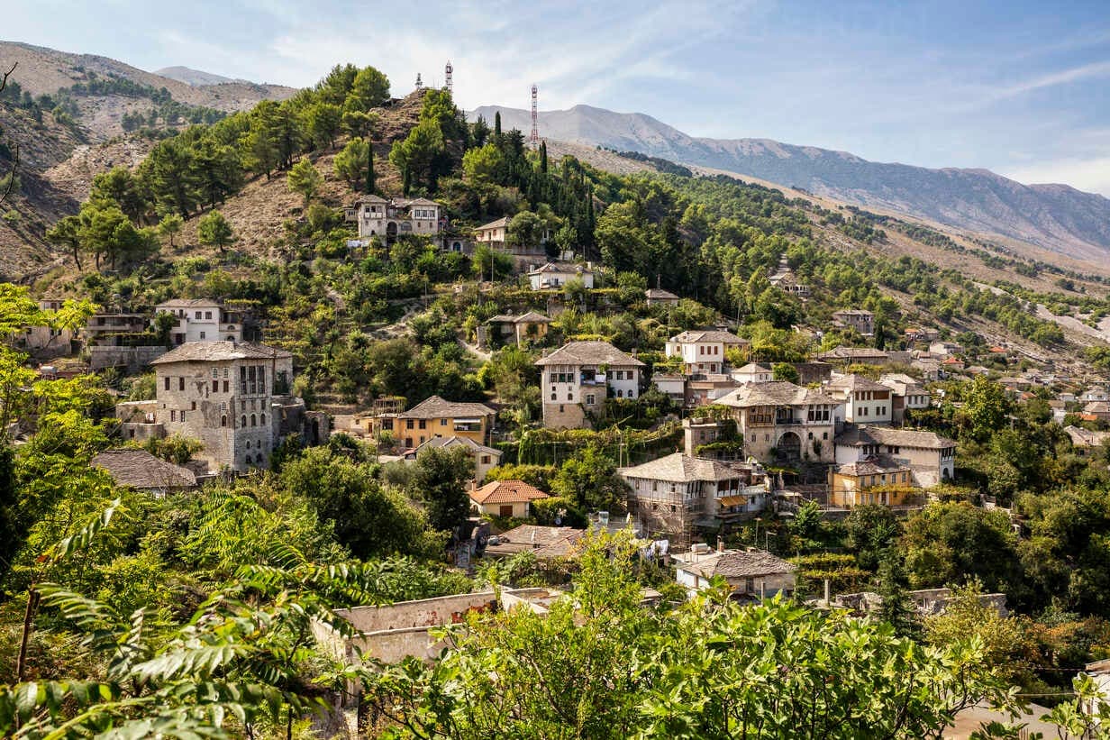
On the eastern slope lies Gjirokastra, a museum town known for its Ottoman castle, stone tower houses, and as the birthplace of Enver Hoxha, communist leader of Albanie from 1944 to 1985. It is the logical starting point for hikes on the eastern slope: accommodation, supplies and vehicle rental are all concentrated here.
Delvina and the western slope
On the other side of the massif, Delvina serves as a base for the western slope. Delvina Castle and the Martyrs' Cemetery are worth a stop. From the town, the Muzina Pass (572 m) opens access to the Drino valley and constitutes a strategic passage between the coast and the hinterland.
When to go
The climate is Mediterranean, with an average annual temperature of around 14 °C.
- May-June: mild temperatures, flowering meadows, ideal hiking conditions
- July-August: hottest months (up to 27 °C in July), August being the driest; favour early starts and identified water sources
- September-October: excellent compromise, clear light and fewer visitors
- December-February: coldest months (around 5 °C in December) and wettest, with annual rainfall of roughly 1,500 mm concentrated in winter — hiking on the peaks is not recommended
Practical information
- Level: regular walkers for ridge routes; accessible to all for the Blue Eye and Muzina Pass
- Duration: allow half a day for the Blue Eye, one to two days for a hike to the main peaks
- Equipment: hiking boots, plenty of water (springs rare in summer), windproof layer, map or GPS
- Accommodation: guesthouses and hotels in Gjirokastra and Delvina, no accommodation at altitude
- Fee: free access to the massif; moderate entrance fee to the Blue Eye site
How to get there
From Tirana, allow around 4 hours by car via the E853 motorway then the SH4 heading south, for roughly 250 km. From Saranda, on the Ionian coast, the Blue Eye is about 30 minutes' drive away. Daily buses connect Tirana to Gjirokastra and Saranda; from these towns, local minibuses or taxis serve the massif's access points. Car rental remains the most flexible way to explore both slopes.
See nearby
Southern Albanie offers several natural extensions to a visit to Mount Gjerë:
- Germenj-Shelegur National Park, to the east, for conifer forests and mid-mountain scenery
- Mount Kokojka, another southern peak accessible to hikers
- Karaburun Peninsula, on the Ionian coast, to combine mountains and coastline
- Farma Sotira, a highland farm inn appreciated for its trout and setting
Planning your trip
Mount Gjerë fits naturally into an itinerary through southern Albanie linking Gjirokastra, Saranda and the Ionian riviera. To build a bespoke itinerary including this massif and its surroundings, consult our trips in Albanie.
Interested in this visit?
We can include it in your personalised itinerary.